Weather Alert in Oregon
Fire Weather Watch issued July 15 at 1:59PM PDT until July 17 at 10:00PM PDT by NWS Pendleton OR
AREAS AFFECTED: John Day Valley; Southern Blue Mountains; Warm Springs Reservation
DESCRIPTION: ...DRY AND WINDY CONDITIONS EXPECTED ACROSS CENTRAL OREGON ON THURSDAY... .An upper level system is expected to pass through the region on Thursday. This, combined with warm and dry conditions, will have the potential to create critical fire weather conditions. The National Weather Service in Pendleton has issued a Fire Weather Watch for wind and low relative humidity, which is in effect from Thursday afternoon through Thursday evening. * AFFECTED AREA...Fire Weather Zones 696 John Day Valley, 698 Southern Blue Mountains and 703 Warm Springs Reservation. * TIMING...From Thursday afternoon through Thursday evening. * WINDS...Northwest 10 to 15 mph. * RELATIVE HUMIDITY...As low as 10 percent. * IMPACTS...Any fire that develops will catch and spread quickly. Outdoor burning is not recommended.
INSTRUCTION: A Fire Weather Watch means that critical fire weather conditions are forecast to occur. Listen for later forecasts and possible Red Flag Warnings.
Want more detail? Get the Complete 7 Day and Night Detailed Forecast!
Current U.S. National Radar--Current
The Current National Weather Radar is shown below with a UTC Time (subtract 5 hours from UTC to get Eastern Time).

National Weather Forecast--Current
The Current National Weather Forecast and National Weather Map are shown below.

National Weather Forecast for Tomorrow
Tomorrow National Weather Forecast and Tomorrow National Weather Map are show below.

North America Water Vapor (Moisture)
This map shows recent moisture content over North America. Bright and colored areas show high moisture (ie, clouds); brown indicates very little moisture present; black indicates no moisture.

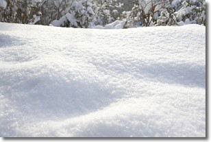
Weather Topic: What is Snow?
Home - Education - Precipitation - Snow
 Next Topic: Stratocumulus Clouds
Snow is precipitation taking the form of ice crystals. Each ice crystal, or snowflake,
has unique characteristics, but all of them grow in a hexagonal structure.
Snowfall can last for sustained periods of time and result in significant buildup
of snow on the ground.
On the earth's surface, snow starts out light and powdery, but as it begins to melt
it tends to become more granular, producing small bits of ice which have the consistency of
sand. After several cycles of melting and freezing, snow can become very dense
and ice-like, commonly known as snow pack.
Next Topic: Stratocumulus Clouds
Weather Topic: What are Stratus Clouds?
Home - Education - Cloud Types - Stratus Clouds
 Next Topic: Wall Clouds
Stratus clouds are similar to altostratus clouds, but form at a
lower altitude and are identified by their fog-like appearance, lacking the
distinguishing features of most clouds.
Stratus clouds are wider than most clouds, and their base has a smooth, uniform
look which is lighter in color than a nimbostratus cloud.
The presence of a stratus cloud indicates the possibility of minor precipitation,
such as drizzle, but heavier precipitation does not typically arrive in the form
of a stratus cloud.
Next Topic: Wall Clouds
Current conditions powered by WeatherAPI.com


