Weather Alert in Colorado
Flood Watch issued August 24 at 2:06PM MDT until August 26 at 12:00AM MDT by NWS Pueblo CO
AREAS AFFECTED: Northern Sangre de Cristo Mountains Between 8500 And 11000 Ft; Northern Sangre de Cristo Mountains above 11000 Ft; Southern Sangre De Cristo Mountains Between 7500 and 11000 Ft; Southern Sangre De Cristo Mountains Above 11000 Ft; Western/Central Fremont County Below 8500 Ft; Wet Mountain Valley Below 8500 Ft; Wet Mountains between 6300 and 10000Ft; Wet Mountains above 10000 Ft; Walsenburg Vicinity/Upper Huerfano River Basin Below 7500 Ft
DESCRIPTION: * WHAT...Flash flooding caused by excessive rainfall is possible. * WHERE...Portions of central and southeast Colorado, including the following areas, in central Colorado, Western/Central Fremont County Below 8500 Feet. In southeast Colorado, Northern Sangre de Cristo Mountains Above 11000 Feet, Northern Sangre de Cristo Mountains Between 8500 And 11000 Feet, Southern Sangre de Cristo Mountains Above 11000 Feet, Southern Sangre de Cristo Mountains Between 7500 and 11000 Feet, Walsenburg Vicinity/Upper Huerfano River Basin Below 7500 Feet, Wet Mountain Valley Below 8500 Feet, Wet Mountains Above 10000 Feet and Wet Mountains between 6300 and 10000 Feet. * WHEN...From Monday afternoon through Monday evening. * IMPACTS...Excessive runoff may result in flooding of rivers, creeks, streams, and other low-lying and flood-prone locations. * ADDITIONAL DETAILS... - Persistent easterly winds, northwest flow aloft, and ample moisture should create thunderstorms over the mountains and mountain valleys with the possibility of training storms. - http://www.weather.gov/safety/flood
INSTRUCTION: You should monitor later forecasts and be prepared to take action should Flash Flood Warnings be issued.
Want more detail? Get the Complete 7 Day and Night Detailed Forecast!
Current U.S. National Radar--Current
The Current National Weather Radar is shown below with a UTC Time (subtract 5 hours from UTC to get Eastern Time).

National Weather Forecast--Current
The Current National Weather Forecast and National Weather Map are shown below.

National Weather Forecast for Tomorrow
Tomorrow National Weather Forecast and Tomorrow National Weather Map are show below.

North America Water Vapor (Moisture)
This map shows recent moisture content over North America. Bright and colored areas show high moisture (ie, clouds); brown indicates very little moisture present; black indicates no moisture.

Weather Topic: What is Snow?
Home - Education - Precipitation - Snow
 Next Topic: Stratocumulus Clouds
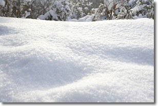
Snow is precipitation taking the form of ice crystals. Each ice crystal, or snowflake,
has unique characteristics, but all of them grow in a hexagonal structure.
Snowfall can last for sustained periods of time and result in significant buildup
of snow on the ground.
On the earth's surface, snow starts out light and powdery, but as it begins to melt
it tends to become more granular, producing small bits of ice which have the consistency of
sand. After several cycles of melting and freezing, snow can become very dense
and ice-like, commonly known as snow pack.
Next Topic: Stratocumulus Clouds
Weather Topic: What are Stratus Clouds?
Home - Education - Cloud Types - Stratus Clouds
 Next Topic: Wall Clouds
Stratus clouds are similar to altostratus clouds, but form at a
lower altitude and are identified by their fog-like appearance, lacking the
distinguishing features of most clouds.
Stratus clouds are wider than most clouds, and their base has a smooth, uniform
look which is lighter in color than a nimbostratus cloud.
The presence of a stratus cloud indicates the possibility of minor precipitation,
such as drizzle, but heavier precipitation does not typically arrive in the form
of a stratus cloud.
Next Topic: Wall Clouds
Current conditions powered by WeatherAPI.com


