Weather Alert in Alaska
Winter Storm Warning issued February 19 at 10:59AM AKST until February 20 at 3:00AM AKST by NWS Juneau AK
AREAS AFFECTED: City and Borough of Yakutat
DESCRIPTION: ...ACCUMULATING SNOW ACROSS THE PANHANDLE TO END THE WEEK... .A front moving across the gulf has begun to impact the panhandle with snow showers spreading along the outer coast and reaching southward to Petersburg and Wrangell as of 1045 am Thursday. The highest snow accumulations are still expected along the outer coast with orographic enhancement. A secondary batch of heavier showers will develop along the northern panhandle and progress southward as a deformation band associated with the surface low Thursday night into Friday. For inland areas, snow is expected to be light and fluffy in nature due to cold temperatures both aloft and down to the surface. Coastal communities will likely see wetter snow due to slightly warming surface temperatures through the day. * WHAT...Heavy snow. Additional snow accumulations of 5 to 8 inches. * WHERE...City and Borough of Yakutat. * WHEN...Until 3 AM AKST Friday. * IMPACTS...Travel will be very difficult. * ADDITIONAL DETAILS...The initial band of snow showers was slightly delayed, which will lead to slightly lower snow totals than previously forecast. A secondary batch of heavier showers is still expected to impact the area in the afternoon and evening hours as a surface low develops and drops southward into the gulf. Temperatures approaching freezing are leading to wetter snow characteristic and this will continue for a majority of the event.
INSTRUCTION: If you must travel, keep an extra flashlight, food, and water with you in case of an emergency. People are urged to prepare their property before the onset of winter weather. For the latest road conditions, where available, call 5 1 1 or visit 511.alaska.gov.
Want more detail? Get the Complete 7 Day and Night Detailed Forecast!
Current U.S. National Radar--Current
The Current National Weather Radar is shown below with a UTC Time (subtract 5 hours from UTC to get Eastern Time).

National Weather Forecast--Current
The Current National Weather Forecast and National Weather Map are shown below.

National Weather Forecast for Tomorrow
Tomorrow National Weather Forecast and Tomorrow National Weather Map are show below.

North America Water Vapor (Moisture)
This map shows recent moisture content over North America. Bright and colored areas show high moisture (ie, clouds); brown indicates very little moisture present; black indicates no moisture.

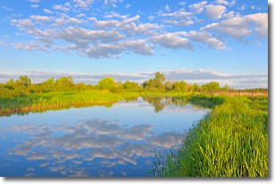
Weather Topic: What are Stratocumulus Clouds?
Home - Education - Cloud Types - Stratocumulus Clouds
 Next Topic: Stratus Clouds
Stratocumulus clouds are similar to altocumulus clouds in their
fluffy appearance, but have a slightly darker shade due to their additional mass.
A good way to distinguish the two cloud types is to hold your hand out and measure
the size of an individual cloud; if it is the size of your thumb it is generally
an altocumulus cloud, if it is the size of your hand it is generally a
stratocumulus cloud.
It is uncommon for stratocumulus clouds to produce precipitation, but if they do
it is usually a light rain or snow.
Next Topic: Stratus Clouds
Weather Topic: What are Wall Clouds?
Home - Education - Cloud Types - Wall Clouds
 Next Topic: Altocumulus Clouds
A wall cloud forms underneath the base of a cumulonimbus cloud,
and can be a hotbed for deadly tornadoes.
Wall clouds are formed by air flowing into the cumulonimbus clouds, which can
result in the wall cloud descending from the base of the cumulonimbus cloud, or
rising fractus clouds which join to the base of the storm cloud as the wall cloud
takes shape.
Wall clouds can be very large, and in the Northern Hemisphere they generally
form at the southern edge of cumulonimbus clouds.
Next Topic: Altocumulus Clouds
Current conditions powered by WeatherAPI.com


