Weather Alert in Minnesota
Winter Storm Warning issued February 17 at 1:58AM CST until February 19 at 12:00PM CST by NWS Duluth MN
AREAS AFFECTED: Central St. Louis; Carlton/South St. Louis
DESCRIPTION: * WHAT...Heavy mixed precipitation expected. Total snow accumulations between 3 and 8 inches except between 4 and 12 inches for the higher terrain northeast of Duluth. Ice accumulations up to one tenth of an inch. Winds gusting as high as 50 mph. * WHERE...Carlton and South and Central St. Louis Counties. This includes the Tribal Lands of the Bois Forte Band, Lake Vermilion area and the Fond du Lac Band. * WHEN...From 6 PM this evening to noon CST Thursday. * IMPACTS...The strong winds and weight of snow on tree limbs may down power lines and could cause sporadic power outages. Travel could be very difficult. The hazardous conditions could impact the Wednesday morning and evening commutes. * ADDITIONAL DETAILS...The strongest winds are expected Tuesday evening through Wednesday morning from the east off Lake Superior. Near whiteout conditions are possible for a few hour period late Tuesday night as high snowfall rates could combine with those peak winds gusting to 55 mph.
INSTRUCTION: If you must travel, keep an extra flashlight, food, and water in your vehicle in case of an emergency. Call 511 or visit www.511mn.org for Minnesota road information. Do not touch downed lines and report any power outages to your electric company. Slick roadways and the possibility of downed trees and power lines may create hazardous travel conditions.
Want more detail? Get the Complete 7 Day and Night Detailed Forecast!
Current U.S. National Radar--Current
The Current National Weather Radar is shown below with a UTC Time (subtract 5 hours from UTC to get Eastern Time).

National Weather Forecast--Current
The Current National Weather Forecast and National Weather Map are shown below.

National Weather Forecast for Tomorrow
Tomorrow National Weather Forecast and Tomorrow National Weather Map are show below.

North America Water Vapor (Moisture)
This map shows recent moisture content over North America. Bright and colored areas show high moisture (ie, clouds); brown indicates very little moisture present; black indicates no moisture.

Weather Topic: What are Contrails?
Home - Education - Cloud Types - Contrails
 Next Topic: Cumulonimbus Clouds
A contrail is an artificial cloud, created by the passing of an
aircraft.
Contrails form because water vapor in the exhaust of aircraft engines is suspended
in the air under certain temperatures and humidity conditions. These contrails
are called exhaust contrails.
Another type of contrail can form due to a temporary reduction in air pressure
moving over the plane's surface, causing condensation.
These are called aerodynamic contrails.
When you can see your breath on a cold day, it is also because of condensation.
The reason contrails last longer than the condensation from your breath is
because the water in contrails freezes into ice particles.
Next Topic: Cumulonimbus Clouds
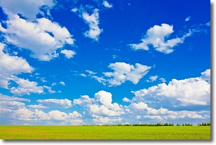
Weather Topic: What are Cumulus Clouds?
Home - Education - Cloud Types - Cumulus Clouds
 Next Topic: Drizzle
Cumulus clouds are fluffy and textured with rounded tops, and
may have flat bottoms. The border of a cumulus cloud
is clearly defined, and can have the appearance of cotton or cauliflower.
Cumulus clouds form at low altitudes (rarely above 2 km) but can grow very tall,
becoming cumulus congestus and possibly the even taller cumulonimbus clouds.
When cumulus clouds become taller, they have a greater chance of producing precipitation.
Next Topic: Drizzle
Current conditions powered by WeatherAPI.com


