Weather Alert in Wisconsin
Special Weather Statement issued February 18 at 7:53AM CST by NWS Green Bay WI
AREAS AFFECTED: Vilas; Oneida; Forest; Florence; Northern Marinette County; Northern Oconto County
DESCRIPTION: A mix of moderate to heavy snow and sleet was occurring across far northern Wisconsin this morning, and will persist near the the Upper Michigan border until around 10 am. The heaviest snow will occur over Vilas, northern Forest, Florence and northern Marinette counties, where accumulations of 1 to 2 inches an hour are possible. On the southern periphery of the heavy snow area, a mix of moderate snow and sleet is expected. Snow and ice covered roads and reduced visibilities will result in hazardous travel conditions until around 10 am. The heaviest snow accumulations; perhaps as high as 6 inches, are expected across Vilas, northern Forest and Florence counties. The heavy concrete nature of the snow will result in tree damage and sporadic power outages. Motorists should use extreme caution, as visibilities will be reduced to less than 1/4 mile at times, and roads will be snow or ice covered and hazardous.
INSTRUCTION: N/A
Want more detail? Get the Complete 7 Day and Night Detailed Forecast!
Current U.S. National Radar--Current
The Current National Weather Radar is shown below with a UTC Time (subtract 5 hours from UTC to get Eastern Time).

National Weather Forecast--Current
The Current National Weather Forecast and National Weather Map are shown below.

National Weather Forecast for Tomorrow
Tomorrow National Weather Forecast and Tomorrow National Weather Map are show below.

North America Water Vapor (Moisture)
This map shows recent moisture content over North America. Bright and colored areas show high moisture (ie, clouds); brown indicates very little moisture present; black indicates no moisture.

Weather Topic: What is Evaporation?
Home - Education - Precipitation - Evaporation
 Next Topic: Fog
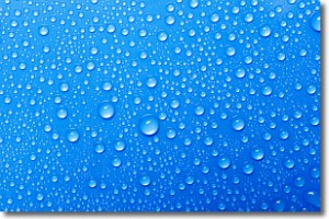
Evaporation is the process which returns water from the earth
back to the atmosphere, and is another crucial process in the water cycle.
Evaporation is the transformation of liquid into gas, and it happens because
molecules are excited by the application of energy and turn into vapor.
In order for water to evaporate it has to be on the surface of a body of water.
Next Topic: Fog
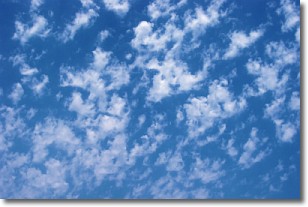
Weather Topic: What are Fractus Clouds?
Home - Education - Cloud Types - Fractus Clouds
 Next Topic: Freezing Rain
A fractus cloud (scud) is a fragmented, tattered cloud which has
likely been sheared off of another cloud. They are accessory clouds, meaning they
develop from parent clouds, and are named in a way which describes the original
cloud which contained them.
Fractus clouds which have originated from cumulus clouds are referred to as
cumulus fractus, while fractus clouds which have originated from stratus clouds
are referred to as stratus fractus. Under certain conditions a fractus cloud might
merge with another cloud, or develop into a cumulus cloud, but usually a
fractus cloud seen by itself will dissipate rapidly.
They are often observed on the leading and trailing edges of storm clouds,
and are a display of wind activity.
Next Topic: Freezing Rain
Current conditions powered by WeatherAPI.com


