Weather Alert in Nebraska
Winter Weather Advisory issued February 18 at 11:53AM CST until February 20 at 12:00AM CST by NWS Hastings NE
AREAS AFFECTED: Nance; Merrick; Polk
DESCRIPTION: ...WINTER RETURNS WITH ACCUMULATING SNOW AND GUSTY WINDS ON THURSDAY... * WHAT...Snow expected. Total snow accumulations between 2 and 4 inches. Northwest winds 20 to 25 mph, gusting 30 to 40 mph. * WHERE...Merrick, Nance, and Polk Counties. * WHEN...From 6 AM Thursday to midnight CST Thursday Night. * IMPACTS...Plan on slippery road conditions. The hazardous conditions could impact the Thursday morning and evening commutes. Gusty winds could lead to areas of blowing and drifting snow and reduced visibility. * ADDITIONAL DETAILS...A narrow band of moderate to heavy snow is forecast to develop Thursday morning and continue through the daytime hours, and perhaps into the evening. The area of heavy snow may be only 40 to 60 miles wide from north to south, so even slight shifts in storm track could lead to big changes in observed snowfall.
INSTRUCTION: Slow down and use caution while traveling. The latest road conditions for the state you are calling from can be obtained by calling 5 1 1.
Want more detail? Get the Complete 7 Day and Night Detailed Forecast!
Current U.S. National Radar--Current
The Current National Weather Radar is shown below with a UTC Time (subtract 5 hours from UTC to get Eastern Time).

National Weather Forecast--Current
The Current National Weather Forecast and National Weather Map are shown below.

National Weather Forecast for Tomorrow
Tomorrow National Weather Forecast and Tomorrow National Weather Map are show below.

North America Water Vapor (Moisture)
This map shows recent moisture content over North America. Bright and colored areas show high moisture (ie, clouds); brown indicates very little moisture present; black indicates no moisture.

Weather Topic: What is Condensation?
Home - Education - Precipitation - Condensation
 Next Topic: Contrails
Condensation is the process which creates clouds, and therefore
it is a crucial process in the water cycle.
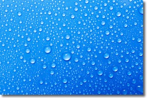
Condensation is the change of matter from a state of gas into a state of liquid,
and it happens because water molecules release heat into the atmosphere and
become organized into a more closely packed structure, what we might see as
water droplets.
Water is always present in the air around us as a vapor, but it's too small for
us to see. When water undergoes the process of condensation it becomes organized
into visible water droplets. You've probably seen condensation happen before on the
surface of a cold drink!
Next Topic: Contrails
Weather Topic: What are Cumulonimbus Clouds?
Home - Education - Cloud Types - Cumulonimbus Clouds
 Next Topic: Cumulus Clouds
The final form taken by a growing cumulus cloud is the
cumulonimbus cloud, which is very tall and dense.
The tower of a cumulonimbus cloud can soar 23 km into the atmosphere, although
most commonly they stop growing at an altitude of 6 km.
Even small cumulonimbus clouds appear very large in comparison to other cloud types.
They can signal the approach of stormy weather, such as thunderstorms or blizzards.
Next Topic: Cumulus Clouds
Current conditions powered by WeatherAPI.com


