Weather Alert in Oregon
Winter Weather Advisory issued February 18 at 10:00AM PST until February 20 at 4:00AM PST by NWS Portland OR
AREAS AFFECTED: North Oregon Coast Range Lowlands; North Oregon Coast Range; Central Oregon Coast Range; Clackamas County Cascade Foothills; Cascade Foothills of Marion and Linn Counties; Lane County Cascade Foothills; Willapa Hills; South Washington Cascade Foothills
DESCRIPTION: ...A SERIES OF WEAK SYSTEMS WILL BRING WIDESPREAD SNOW TO THE NORTHERN OREGON AND SOUTHERN WASHINGTON COAST AND CASCADE RANGES THROUGH AT LEAST THURSDAY NIGHT... .A broad area of low pressure will continue to bring widespread snow showers to elevations above 1000 ft through at least Thursday night. Given the showery nature of the precipitation and uncertainty as to the track of tonight's system, there is some variability in forecast total snow fall accumulations through Thursday night. While the forecast remains on track for overall snowfall totals, where exactly the highest snow accumulations occur remain in flux. * WHAT...Snow. Additional snow accumulations of 2 to 7 inches through tonight and another 1 to 3 inches of snow Thursday morning through Thursday night. * WHERE...Foothills of the Northern and Central Oregon Cascades, North and Central Coast Range Mountains of Oregon, North Oregon Coast Range Lowlands, Willapa Hills, and South Washington Cascade Foothills. * WHEN...Until 4 AM PST Friday. * IMPACTS...Roads, and especially bridges and overpasses, will likely become slick and hazardous.
INSTRUCTION: Have a winter emergency driving kit readily available. Common items to include: flashlight, batteries, blankets, a shovel, water, non-perishable food items, tire chains, etc. Be aware that walking surfaces may be slick. Walk with extra care. For the latest road conditions and chain restrictions in Oregon, call 5 1 1, or visit: www.tripcheck.com. For the latest road conditions and chain restrictions in Washington, visit: wsdot.com/travel/real-time/map
Want more detail? Get the Complete 7 Day and Night Detailed Forecast!
Current U.S. National Radar--Current
The Current National Weather Radar is shown below with a UTC Time (subtract 5 hours from UTC to get Eastern Time).

National Weather Forecast--Current
The Current National Weather Forecast and National Weather Map are shown below.

National Weather Forecast for Tomorrow
Tomorrow National Weather Forecast and Tomorrow National Weather Map are show below.

North America Water Vapor (Moisture)
This map shows recent moisture content over North America. Bright and colored areas show high moisture (ie, clouds); brown indicates very little moisture present; black indicates no moisture.

Weather Topic: What is Evaporation?
Home - Education - Precipitation - Evaporation
 Next Topic: Fog
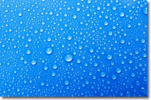
Evaporation is the process which returns water from the earth
back to the atmosphere, and is another crucial process in the water cycle.
Evaporation is the transformation of liquid into gas, and it happens because
molecules are excited by the application of energy and turn into vapor.
In order for water to evaporate it has to be on the surface of a body of water.
Next Topic: Fog
Weather Topic: What are Fractus Clouds?
Home - Education - Cloud Types - Fractus Clouds
 Next Topic: Freezing Rain
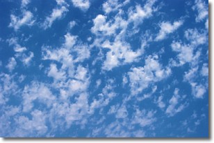
A fractus cloud (scud) is a fragmented, tattered cloud which has
likely been sheared off of another cloud. They are accessory clouds, meaning they
develop from parent clouds, and are named in a way which describes the original
cloud which contained them.
Fractus clouds which have originated from cumulus clouds are referred to as
cumulus fractus, while fractus clouds which have originated from stratus clouds
are referred to as stratus fractus. Under certain conditions a fractus cloud might
merge with another cloud, or develop into a cumulus cloud, but usually a
fractus cloud seen by itself will dissipate rapidly.
They are often observed on the leading and trailing edges of storm clouds,
and are a display of wind activity.
Next Topic: Freezing Rain
Current conditions powered by WeatherAPI.com


