Weather Alert in California
Fire Weather Watch issued June 19 at 12:24PM PDT until June 22 at 11:00AM PDT by NWS Sacramento CA
AREAS AFFECTED: Northern Sacramento Valley to Southern Tehama County Line Below 1000 Ft; Central Sacramento Valley including Glenn/Colusa/Yuba/Northern Sutter/Butte County Below 1000 Ft; Southern Sacramento Valley In Yolo/Sacramento/Far Western Placer/Southern Sutter and Solano County Below 1000 Ft - Excludes the Delta; Eastern Delta; Northern San Joaquin Valley in San Joaquin and Stanislaus Counties Below 1000 ft - Excludes the Delta; Southern Motherlode From 1000 to 3000 Ft/Calaveras and Toulumne Counties; Southeast Edge Shasta/Trinity NF and Western Portions of Tehama/Glenn RU; Northern Sierra Foothills from 1000 to 3000 Ft. Includes Nevada-Yuba-Placer RU and Anador-Eldorado RU; Eastern Mendocino NF
DESCRIPTION: The National Weather Service in Sacramento has issued a Fire Weather Watch for gusty winds and low humidity, which is in effect from Saturday morning through Sunday morning. * Winds...North winds 15 to 25 mph with gusts up of 30 to 40 mph. Strongest winds expected across the Sacramento Valley along and west of Interstate 5, the Delta, and the northern San Joaquin Valley. * Humidity...Minimum daytime humidity: 15 to 25 percent. Overnight recoveries in the mid 40s to mid 50s. * Highest Threat...Sacramento Valley along and west of the I-5 corridor, adjacent Coastal Range, and the northern San Joaquin Valley. * Impacts...The combination of gusty winds and low humidity can cause fire to rapidly grow in size and intensity. Outdoor burning is not recommended.
INSTRUCTION: A Fire Weather Watch means that critical fire weather conditions are forecast to occur. Listen for later forecasts and possible Red Flag Warnings.
Want more detail? Get the Complete 7 Day and Night Detailed Forecast!
Current U.S. National Radar--Current
The Current National Weather Radar is shown below with a UTC Time (subtract 5 hours from UTC to get Eastern Time).

National Weather Forecast--Current
The Current National Weather Forecast and National Weather Map are shown below.

National Weather Forecast for Tomorrow
Tomorrow National Weather Forecast and Tomorrow National Weather Map are show below.

North America Water Vapor (Moisture)
This map shows recent moisture content over North America. Bright and colored areas show high moisture (ie, clouds); brown indicates very little moisture present; black indicates no moisture.

Weather Topic: What is Evaporation?
Home - Education - Precipitation - Evaporation
 Next Topic: Fog
Evaporation is the process which returns water from the earth
back to the atmosphere, and is another crucial process in the water cycle.
Evaporation is the transformation of liquid into gas, and it happens because
molecules are excited by the application of energy and turn into vapor.
In order for water to evaporate it has to be on the surface of a body of water.
Next Topic: Fog
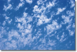
Weather Topic: What are Fractus Clouds?
Home - Education - Cloud Types - Fractus Clouds
 Next Topic: Freezing Rain
A fractus cloud (scud) is a fragmented, tattered cloud which has
likely been sheared off of another cloud. They are accessory clouds, meaning they
develop from parent clouds, and are named in a way which describes the original
cloud which contained them.
Fractus clouds which have originated from cumulus clouds are referred to as
cumulus fractus, while fractus clouds which have originated from stratus clouds
are referred to as stratus fractus. Under certain conditions a fractus cloud might
merge with another cloud, or develop into a cumulus cloud, but usually a
fractus cloud seen by itself will dissipate rapidly.
They are often observed on the leading and trailing edges of storm clouds,
and are a display of wind activity.
Next Topic: Freezing Rain
Current conditions powered by WeatherAPI.com


