Weather Alert in California
Flash Flood Warning issued February 16 at 1:48PM PST until February 16 at 4:00PM PST by NWS Los Angeles/Oxnard CA
AREAS AFFECTED: Los Angeles, CA
DESCRIPTION: FFWLOX The National Weather Service in Los Angeles/Oxnard has extended the * Flash Flood Warning for... Southeastern Los Angeles County in southwestern California... * Until 400 PM PST. * At 148 PM PST, local law enforcement reported flash flooding already developing from heavy showers and thunderstorms across the warned area. Flash flooding is already occurring. Rock slides and mud slides are expected. Debris flows on the burn scars. HAZARD...Life threatening flash flooding. Thunderstorms producing flash flooding. Significant rock slides and mud slides. Debris flows. SOURCE...Law enforcement reported. IMPACT...Life threatening flash flooding of creeks and streams, urban areas, highways, streets and underpasses. Significant rock slides and mud slides. Debris flows. * Some locations that will experience flash flooding include... Alhambra, Downtown Los Angeles, Pasadena, Griffith Park, Hollywood, Burbank, Universal City, Mount Wilson, Inglewood, Beverly Hills, Whittier, Culver City, North Hollywood, Altadena, Eagle Rock, Glendale, La Canada Flintridge, Hancock Park, Hollywood Hills and Toluca Lake. Burn scars, such as Eaton and eastern Palisades.
INSTRUCTION: Turn around, don't drown when encountering flooded roads. Most flood deaths occur in vehicles. Be aware of your surroundings and do not drive on flooded roads, and be aware of rock slides and mud slides around high terrain. Follow direction of Emergency Management and Law Enforcement officials.
Want more detail? Get the Complete 7 Day and Night Detailed Forecast!
Current U.S. National Radar--Current
The Current National Weather Radar is shown below with a UTC Time (subtract 5 hours from UTC to get Eastern Time).

National Weather Forecast--Current
The Current National Weather Forecast and National Weather Map are shown below.

National Weather Forecast for Tomorrow
Tomorrow National Weather Forecast and Tomorrow National Weather Map are show below.

North America Water Vapor (Moisture)
This map shows recent moisture content over North America. Bright and colored areas show high moisture (ie, clouds); brown indicates very little moisture present; black indicates no moisture.

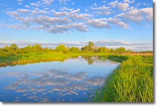
Weather Topic: What are Stratocumulus Clouds?
Home - Education - Cloud Types - Stratocumulus Clouds
 Next Topic: Stratus Clouds
Stratocumulus clouds are similar to altocumulus clouds in their
fluffy appearance, but have a slightly darker shade due to their additional mass.
A good way to distinguish the two cloud types is to hold your hand out and measure
the size of an individual cloud; if it is the size of your thumb it is generally
an altocumulus cloud, if it is the size of your hand it is generally a
stratocumulus cloud.
It is uncommon for stratocumulus clouds to produce precipitation, but if they do
it is usually a light rain or snow.
Next Topic: Stratus Clouds
Weather Topic: What are Wall Clouds?
Home - Education - Cloud Types - Wall Clouds
 Next Topic: Altocumulus Clouds
A wall cloud forms underneath the base of a cumulonimbus cloud,
and can be a hotbed for deadly tornadoes.
Wall clouds are formed by air flowing into the cumulonimbus clouds, which can
result in the wall cloud descending from the base of the cumulonimbus cloud, or
rising fractus clouds which join to the base of the storm cloud as the wall cloud
takes shape.
Wall clouds can be very large, and in the Northern Hemisphere they generally
form at the southern edge of cumulonimbus clouds.
Next Topic: Altocumulus Clouds
Current conditions powered by WeatherAPI.com


