Weather Alert in Montana
Winter Storm Warning issued March 12 at 5:09AM MDT until March 14 at 12:00PM MDT by NWS Missoula MT
AREAS AFFECTED: Lower Clark Fork Region
DESCRIPTION: * WHAT...Heavy snow and blowing snow expected. There is a likelihood of extreme winter storm impacts. Total snow accumulations 2 to 6 inches in the lower elevations and 1 to 2 feet on I-90 over Lookout Pass and the higher terrain. Wind gusts of 45 to 65 mph. * WHERE...I-90 Lookout Pass to Haugan, Highway 200 Thompson Falls to Plains, Highway 200 Trout Creek to Heron, and Evaro Hill. * WHEN...Until noon MDT Saturday. * IMPACTS...For EXTREME winter storm impacts, expect substantial disruptions to normal activities. Extremely dangerous or impossible traveling conditions. Travel in the impacted areas is not advised. Extensive and widespread closures and disruptions to infrastructure may occur. * ADDITIONAL DETAILS...Strong and potentially damaging winds will impact all elevations this morning. Periods of blizzard conditions will impact Lookout Pass and the higher elevations this morning.
INSTRUCTION: Persons should delay all travel if possible. If travel is absolutely necessary, drive with extreme caution and be prepared for sudden changes in visibility. Leave plenty of room between you and the motorist ahead of you, and allow extra time to reach your destination. Avoid sudden braking or acceleration, and be especially cautious on hills or when making turns. Make sure your car is winterized and in good working order. Do not touch downed lines and report any power outages to your electric company. Travel is highly discouraged due to slick roadways and the possibility of downed trees and power lines.
Want more detail? Get the Complete 7 Day and Night Detailed Forecast!
Current U.S. National Radar--Current
The Current National Weather Radar is shown below with a UTC Time (subtract 5 hours from UTC to get Eastern Time).

National Weather Forecast--Current
The Current National Weather Forecast and National Weather Map are shown below.

National Weather Forecast for Tomorrow
Tomorrow National Weather Forecast and Tomorrow National Weather Map are show below.

North America Water Vapor (Moisture)
This map shows recent moisture content over North America. Bright and colored areas show high moisture (ie, clouds); brown indicates very little moisture present; black indicates no moisture.

Weather Topic: What are Cirrostratus Clouds?
Home - Education - Cloud Types - Cirrostratus Clouds
 Next Topic: Cirrus Clouds
Cirrostratus clouds are high, thin clouds that form above
20,000 feet and are made mostly of ice crystals. They sometimes look like giant
feathers, horse tails, or curls of hair in the sky.
These clouds are pushed by the jet stream and can move at high speeds reaching
100 mph.
What do they indicate?
They indicate that a precipitation is likely within 24 hours.
Next Topic: Cirrus Clouds
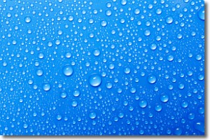
Weather Topic: What is Condensation?
Home - Education - Precipitation - Condensation
 Next Topic: Contrails
Condensation is the process which creates clouds, and therefore
it is a crucial process in the water cycle.
Condensation is the change of matter from a state of gas into a state of liquid,
and it happens because water molecules release heat into the atmosphere and
become organized into a more closely packed structure, what we might see as
water droplets.
Water is always present in the air around us as a vapor, but it's too small for
us to see. When water undergoes the process of condensation it becomes organized
into visible water droplets. You've probably seen condensation happen before on the
surface of a cold drink!
Next Topic: Contrails
Current conditions powered by WeatherAPI.com


