Weather Alert in California
Flood Watch High Surf Advisory High Wind Warning Wind Advisory Winter Storm Warning
Winter Storm Warning issued February 16 at 10:53AM PST until February 18 at 12:00PM PST by NWS San Diego CA
AREAS AFFECTED: San Bernardino County Mountains; Riverside County Mountains
DESCRIPTION: * WHAT...Heavy snow expected. Through Tuesday morning, snowfall of 4 to 8 inches is expected from 5500 to 6000 feet, 8 to 16 inches from 6000 to 7000 feet, and locally 2 to 3 feet above 7500 feet. Southwest winds will gust to 45 to 55 mph. Snow levels will fall to 5000 to 5500 feet for late tonight into Tuesday. Another round of more widespread precipitation is expected for Tuesday night into Wednesday morning with additional snowfall of 3 to 8 inches from 5000 to 6000 feet, 8 to 16 inches from 6000 to 7000 feet, and 16 to 20 inches above 7000 feet. The snow level will fall to 3500 to 4500 feet for Wednesday afternoon into Thursday. Southwest winds for Tuesday night through Wednesday afternoon will gust to 55 to 75 mph on the desert slopes of the mountains. * WHERE...Riverside County Mountains and San Bernardino County Mountains. * WHEN...Until noon PST Wednesday. * IMPACTS...Travel could be very difficult to impossible. The hazardous conditions could impact the Monday evening and Tuesday morning commutes. Very strong winds could cause extensive tree damage. * ADDITIONAL DETAILS...Wednesday night into Thursday up to an inch of snow could accumulate below 5000 ft, with 2-4 inches of additional snowfall above 5000 ft.
INSTRUCTION: If you must travel, keep an extra flashlight, food, and water in your vehicle in case of an emergency. The latest road conditions for the state you are calling from can be obtained by calling 5 1 1.
Want more detail? Get the Complete 7 Day and Night Detailed Forecast!
Current U.S. National Radar--Current
The Current National Weather Radar is shown below with a UTC Time (subtract 5 hours from UTC to get Eastern Time).

National Weather Forecast--Current
The Current National Weather Forecast and National Weather Map are shown below.

National Weather Forecast for Tomorrow
Tomorrow National Weather Forecast and Tomorrow National Weather Map are show below.

North America Water Vapor (Moisture)
This map shows recent moisture content over North America. Bright and colored areas show high moisture (ie, clouds); brown indicates very little moisture present; black indicates no moisture.

Weather Topic: What are Shelf Clouds?
Home - Education - Cloud Types - Shelf Clouds
 Next Topic: Sleet
A shelf cloud is similar to a wall cloud, but forms at the front
of a storm cloud, instead of at the rear, where wall clouds form.
A shelf cloud is caused by a series of events set into motion by the advancing
storm; first, cool air settles along the ground where precipitation has just fallen.
As the cool air is brought in, the warmer air is displaced, and rises above it,
because it is less dense. When the warmer air reaches the bottom of the storm cloud,
it begins to cool again, and the resulting condensation is a visible shelf cloud.
Next Topic: Sleet
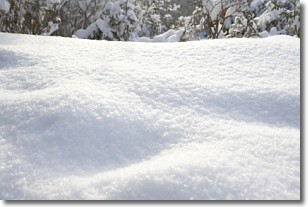
Weather Topic: What is Snow?
Home - Education - Precipitation - Snow
 Next Topic: Stratocumulus Clouds
Snow is precipitation taking the form of ice crystals. Each ice crystal, or snowflake,
has unique characteristics, but all of them grow in a hexagonal structure.
Snowfall can last for sustained periods of time and result in significant buildup
of snow on the ground.
On the earth's surface, snow starts out light and powdery, but as it begins to melt
it tends to become more granular, producing small bits of ice which have the consistency of
sand. After several cycles of melting and freezing, snow can become very dense
and ice-like, commonly known as snow pack.
Next Topic: Stratocumulus Clouds
Current conditions powered by WeatherAPI.com


