Weather Alert in Colorado
High Wind Warning issued March 12 at 11:09AM MDT until March 13 at 12:00PM MDT by NWS Denver CO
AREAS AFFECTED: South and East Jackson/Larimer/North and Northeast Grand/Northwest Boulder Counties Above 9000 Feet; South and Southeast Grand/West Central and Southwest Boulder/Gilpin/Clear Creek/Summit/North and West Park Counties Above 9000 Feet; Larimer and Boulder Counties Between 6000 and 9000 Feet
DESCRIPTION: * WHAT...West winds 35 to 50 mph with gusts 80 to 100 mph expected. * WHERE...Rocky Mountain National Park and the Medicine Bow Range, The Mountains of Summit County, the Mosquito Range, the Indian Peaks, and The Northern Front Range Foothills. * WHEN...Until noon MDT Friday. * IMPACTS...Damaging winds may blow down trees and power lines, and scattered power outages are possible. Travel will be difficult, especially for high profile vehicles. This includes U.S. 40 over Berthoud Pass, I-70 from Golden to the Eisenhower Tunnel, and the Peak to Peak Highway. Strong winds may lead to rapid growth of any new fires, particularly below 7,500 ft.
INSTRUCTION: Drivers of high profile vehicles should consider delaying travel until winds subside Friday afternoon. People are urged to secure loose objects that could be blown around or damaged by the wind.
Want more detail? Get the Complete 7 Day and Night Detailed Forecast!
Current U.S. National Radar--Current
The Current National Weather Radar is shown below with a UTC Time (subtract 5 hours from UTC to get Eastern Time).

National Weather Forecast--Current
The Current National Weather Forecast and National Weather Map are shown below.

National Weather Forecast for Tomorrow
Tomorrow National Weather Forecast and Tomorrow National Weather Map are show below.

North America Water Vapor (Moisture)
This map shows recent moisture content over North America. Bright and colored areas show high moisture (ie, clouds); brown indicates very little moisture present; black indicates no moisture.

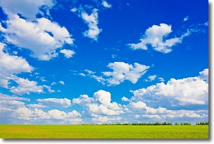
Weather Topic: What are Cumulus Clouds?
Home - Education - Cloud Types - Cumulus Clouds
 Next Topic: Drizzle
Cumulus clouds are fluffy and textured with rounded tops, and
may have flat bottoms. The border of a cumulus cloud
is clearly defined, and can have the appearance of cotton or cauliflower.
Cumulus clouds form at low altitudes (rarely above 2 km) but can grow very tall,
becoming cumulus congestus and possibly the even taller cumulonimbus clouds.
When cumulus clouds become taller, they have a greater chance of producing precipitation.
Next Topic: Drizzle
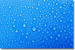
Weather Topic: What is Evaporation?
Home - Education - Precipitation - Evaporation
 Next Topic: Fog
Evaporation is the process which returns water from the earth
back to the atmosphere, and is another crucial process in the water cycle.
Evaporation is the transformation of liquid into gas, and it happens because
molecules are excited by the application of energy and turn into vapor.
In order for water to evaporate it has to be on the surface of a body of water.
Next Topic: Fog
Current conditions powered by WeatherAPI.com


