Weather Alert in California
Fire Weather Watch issued September 1 at 12:11AM PDT until September 2 at 8:00PM PDT by NWS Eureka CA
AREAS AFFECTED: Lower Middle Klamath; W Mendocino NF/E Mendocino Unit; Trinity
DESCRIPTION: ...ISOLATED DRY THUNDERSTORMS TUESDAY AFTERNOON AND EARLY EVENING... .Isolated dry thunderstorms are possible over the interior Tuesday afternoon and into early evening. Threats include erratic gusty winds and lightning. Lightning on dry fuels may lead to new fire starts. In addition, gusty winds combined with hot temperatures and low relative humidity will also produce near critical fire weather conditions. Existing fires and any new fire will have the potential to spread rapidly. * AFFECTED AREA...Fire weather zone 204, 277 and 283. * THUNDERSTORMS...Isolated dry storms over high terrain in the afternoon and early evening hours. * OUTFLOW WINDS...Gusty and erratic outflow winds over 40 mph. * IMPACTS...any fires that develop will likely spread rapidly. Outdoor burning is not recommended. * Additional Impacts...Hot, dry weather and breezy winds will increase the fire danger even in areas away from thunderstorms.
INSTRUCTION: A Fire Weather Watch means that critical fire weather conditions are forecast to occur. Listen for later forecasts and possible Red Flag Warnings.
Want more detail? Get the Complete 7 Day and Night Detailed Forecast!
Current U.S. National Radar--Current
The Current National Weather Radar is shown below with a UTC Time (subtract 5 hours from UTC to get Eastern Time).

National Weather Forecast--Current
The Current National Weather Forecast and National Weather Map are shown below.

National Weather Forecast for Tomorrow
Tomorrow National Weather Forecast and Tomorrow National Weather Map are show below.

North America Water Vapor (Moisture)
This map shows recent moisture content over North America. Bright and colored areas show high moisture (ie, clouds); brown indicates very little moisture present; black indicates no moisture.

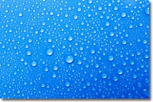
Weather Topic: What is Evaporation?
Home - Education - Precipitation - Evaporation
 Next Topic: Fog
Evaporation is the process which returns water from the earth
back to the atmosphere, and is another crucial process in the water cycle.
Evaporation is the transformation of liquid into gas, and it happens because
molecules are excited by the application of energy and turn into vapor.
In order for water to evaporate it has to be on the surface of a body of water.
Next Topic: Fog
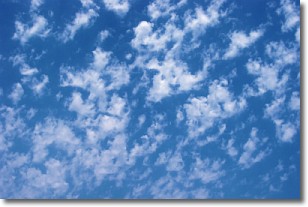
Weather Topic: What are Fractus Clouds?
Home - Education - Cloud Types - Fractus Clouds
 Next Topic: Freezing Rain
A fractus cloud (scud) is a fragmented, tattered cloud which has
likely been sheared off of another cloud. They are accessory clouds, meaning they
develop from parent clouds, and are named in a way which describes the original
cloud which contained them.
Fractus clouds which have originated from cumulus clouds are referred to as
cumulus fractus, while fractus clouds which have originated from stratus clouds
are referred to as stratus fractus. Under certain conditions a fractus cloud might
merge with another cloud, or develop into a cumulus cloud, but usually a
fractus cloud seen by itself will dissipate rapidly.
They are often observed on the leading and trailing edges of storm clouds,
and are a display of wind activity.
Next Topic: Freezing Rain
Current conditions powered by WeatherAPI.com


