Weather Alert in California
Winter Weather Advisory issued February 19 at 12:25AM PST until February 19 at 7:00PM PST by NWS Medford OR
AREAS AFFECTED: Modoc County; Northern and Eastern Klamath County and Western Lake County; Central and Eastern Lake County
DESCRIPTION: * WHAT...Snow expected. Total snow accumulations 2 to 6 inches, with highest amounts in the Warner Mountains. A majority of the snow is expected from 7 AM PST to 2 PM PST today, with light snow showers then tapering off into the evening. * WHERE...Winter Rim in Klamath county, Lake County, and Modoc County. Including the locations of...Adin, Alturas, Canby, Day, Likely, Bly, Adel, Fort Rock, Lakeview, Valley Falls, and Paisley. This also includes the following passes or notable locations... Cedar Pass on state highway 239 at 6323 ft. Warner Mountain Summit on state highway 140 at 5850 ft. * WHEN...Until 7 PM PST this evening. * IMPACTS...Roads, and especially bridges and overpasses, will likely become slick and hazardous. Plan on slippery road conditions and delays in your commutes. * ADDITIONAL DETAILS...Visit weather.gov/mfr/winter for additional snow probabilities
INSTRUCTION: Slow down and use caution while traveling. In California, call 511 or visit quickmap.dot.ca.gov for road information. In Oregon, call 511 or visit tripcheck.com for road information. Be prepared for slippery roads. Slow down and use caution while driving. If you are going outside, watch your first few steps taken on stairs, sidewalks, and driveways. These surfaces could be icy and slippery, increasing your risk of a fall and injury.
Want more detail? Get the Complete 7 Day and Night Detailed Forecast!
Current U.S. National Radar--Current
The Current National Weather Radar is shown below with a UTC Time (subtract 5 hours from UTC to get Eastern Time).

National Weather Forecast--Current
The Current National Weather Forecast and National Weather Map are shown below.

National Weather Forecast for Tomorrow
Tomorrow National Weather Forecast and Tomorrow National Weather Map are show below.

North America Water Vapor (Moisture)
This map shows recent moisture content over North America. Bright and colored areas show high moisture (ie, clouds); brown indicates very little moisture present; black indicates no moisture.

Weather Topic: What is Snow?
Home - Education - Precipitation - Snow
 Next Topic: Stratocumulus Clouds
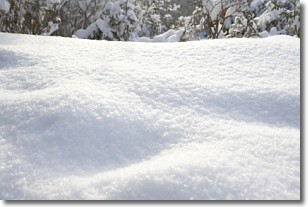
Snow is precipitation taking the form of ice crystals. Each ice crystal, or snowflake,
has unique characteristics, but all of them grow in a hexagonal structure.
Snowfall can last for sustained periods of time and result in significant buildup
of snow on the ground.
On the earth's surface, snow starts out light and powdery, but as it begins to melt
it tends to become more granular, producing small bits of ice which have the consistency of
sand. After several cycles of melting and freezing, snow can become very dense
and ice-like, commonly known as snow pack.
Next Topic: Stratocumulus Clouds
Weather Topic: What are Stratus Clouds?
Home - Education - Cloud Types - Stratus Clouds
 Next Topic: Wall Clouds
Stratus clouds are similar to altostratus clouds, but form at a
lower altitude and are identified by their fog-like appearance, lacking the
distinguishing features of most clouds.
Stratus clouds are wider than most clouds, and their base has a smooth, uniform
look which is lighter in color than a nimbostratus cloud.
The presence of a stratus cloud indicates the possibility of minor precipitation,
such as drizzle, but heavier precipitation does not typically arrive in the form
of a stratus cloud.
Next Topic: Wall Clouds
Current conditions powered by WeatherAPI.com


