Weather Alert in Iowa
Winter Storm Watch issued March 14 at 6:11AM CDT until March 16 at 1:00PM CDT by NWS La Crosse WI
AREAS AFFECTED: Mitchell; Howard; Winneshiek; Allamakee; Crawford; Richland
DESCRIPTION: ...MAJOR WINTER STORM TONIGHT INTO MONDAY MORNING... .A prolonged, high-impact winter storm affects the region tonight through Monday morning. Highest snow totals in excess of 12 to 18 inches are favored north of Interstate 90 with some locales north of Highway 10 approaching 24 inches. Along Interstate 90, a wintry mix of snow, freezing rain, and sleet makes it difficult to pin down exact snow and ice amounts, but impacts do warrant a Winter Storm Warning. Across northeast Iowa and southwest Wisconsin, snow does not look to arrive until Sunday afternoon, so the Winter Storm Watch is maintained for now. Increasing winds Sunday afternoon and night should result in whiteout conditions for exposed locales and an upgrade to a Blizzard Warning is likely once the exact threat area is determined. Regardless of exact snow amounts, expect major travel impacts regionwide with some roads possibly impassable, especially in wind-prone areas. * WHAT...For the Winter Weather Advisory tonight into early Sunday afternoon, mixed precipitation expected. Total snow accumulations up to one inch and ice accumulations around one tenth of an inch. Winds gusting as high as 40 mph. For the Winter Storm Watch Sunday afternoon into Sunday night, heavy mixed precipitation possible. Total snow and sleet accumulations between 4 and 9 inches and ice accumulations around a light glaze possible. Winds could gust as high as 50 mph leading to potential blizzard conditions. * WHERE...Portions of north central and northeast Iowa and southwest Wisconsin. * WHEN...For the Winter Weather Advisory, from 1 AM to 1 PM CDT Sunday. For the Winter Storm Watch, from Sunday afternoon through Monday afternoon. * IMPACTS...Travel could be very difficult. Widespread blowing snow could significantly reduce visibility. The hazardous conditions could impact the Monday morning commute. Gusty winds could bring down tree branches.
INSTRUCTION: Slow down and use caution while traveling. In Iowa, visit 511ia.org for road conditions. In Wisconsin, visit 511wi.gov for road conditions. Monitor the latest forecasts for updates on this situation.
Want more detail? Get the Complete 7 Day and Night Detailed Forecast!
Current U.S. National Radar--Current
The Current National Weather Radar is shown below with a UTC Time (subtract 5 hours from UTC to get Eastern Time).

National Weather Forecast--Current
The Current National Weather Forecast and National Weather Map are shown below.

National Weather Forecast for Tomorrow
Tomorrow National Weather Forecast and Tomorrow National Weather Map are show below.

North America Water Vapor (Moisture)
This map shows recent moisture content over North America. Bright and colored areas show high moisture (ie, clouds); brown indicates very little moisture present; black indicates no moisture.

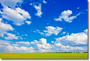
Weather Topic: What are Cumulus Clouds?
Home - Education - Cloud Types - Cumulus Clouds
 Next Topic: Drizzle
Cumulus clouds are fluffy and textured with rounded tops, and
may have flat bottoms. The border of a cumulus cloud
is clearly defined, and can have the appearance of cotton or cauliflower.
Cumulus clouds form at low altitudes (rarely above 2 km) but can grow very tall,
becoming cumulus congestus and possibly the even taller cumulonimbus clouds.
When cumulus clouds become taller, they have a greater chance of producing precipitation.
Next Topic: Drizzle
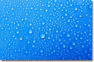
Weather Topic: What is Evaporation?
Home - Education - Precipitation - Evaporation
 Next Topic: Fog
Evaporation is the process which returns water from the earth
back to the atmosphere, and is another crucial process in the water cycle.
Evaporation is the transformation of liquid into gas, and it happens because
molecules are excited by the application of energy and turn into vapor.
In order for water to evaporate it has to be on the surface of a body of water.
Next Topic: Fog
Current conditions powered by WeatherAPI.com


