Weather Alert in Indiana
Special Weather Statement issued June 5 at 5:13AM EDT by NWS Northern Indiana
AREAS AFFECTED: Elkhart; Lagrange; Steuben; Noble; De Kalb; Starke; Pulaski; Marshall; Fulton; Whitley; Allen; White; Cass; Miami; Wabash; Huntington; Wells; Adams; Grant; Blackford; Jay; Northern La Porte; Eastern St. Joseph; Northern Kosciusko; Southern La Porte; Western St. Joseph; Southern Kosciusko; Cass; St. Joseph; Branch; Hillsdale; Northern Berrien; Southern Berrien; Williams; Fulton; Defiance; Henry; Paulding; Putnam; Van Wert; Allen
DESCRIPTION: Heavy rainfall fell across portions of the area overnight, particularly along and west of I-69. Light rainfall continues and should slowly taper off through the morning hours. However, motorists should be on the lookout for standing water on roadways. Do not use cruise control, and allow yourself extra distance between you and those in front of you. Elsewhere, patchy fog due to saturated soils has began to develop this morning across portions of northern Indiana, southwest Michigan, and northwest Ohio. Allow extra spacing between vehicles and use your low-beam headlights.
INSTRUCTION: N/A
Want more detail? Get the Complete 7 Day and Night Detailed Forecast!
Current U.S. National Radar--Current
The Current National Weather Radar is shown below with a UTC Time (subtract 5 hours from UTC to get Eastern Time).

National Weather Forecast--Current
The Current National Weather Forecast and National Weather Map are shown below.

National Weather Forecast for Tomorrow
Tomorrow National Weather Forecast and Tomorrow National Weather Map are show below.

North America Water Vapor (Moisture)
This map shows recent moisture content over North America. Bright and colored areas show high moisture (ie, clouds); brown indicates very little moisture present; black indicates no moisture.

Weather Topic: What are Cumulus Clouds?
Home - Education - Cloud Types - Cumulus Clouds
 Next Topic: Drizzle
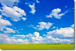
Cumulus clouds are fluffy and textured with rounded tops, and
may have flat bottoms. The border of a cumulus cloud
is clearly defined, and can have the appearance of cotton or cauliflower.
Cumulus clouds form at low altitudes (rarely above 2 km) but can grow very tall,
becoming cumulus congestus and possibly the even taller cumulonimbus clouds.
When cumulus clouds become taller, they have a greater chance of producing precipitation.
Next Topic: Drizzle
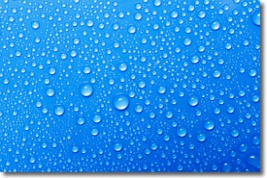
Weather Topic: What is Evaporation?
Home - Education - Precipitation - Evaporation
 Next Topic: Fog
Evaporation is the process which returns water from the earth
back to the atmosphere, and is another crucial process in the water cycle.
Evaporation is the transformation of liquid into gas, and it happens because
molecules are excited by the application of energy and turn into vapor.
In order for water to evaporate it has to be on the surface of a body of water.
Next Topic: Fog
Current conditions powered by WeatherAPI.com


