Weather Alert in Colorado
Flood Watch issued September 11 at 2:51AM MDT until September 13 at 12:00AM MDT by NWS Grand Junction CO
AREAS AFFECTED: Roan and Tavaputs Plateaus; Grand Valley; Debeque to Silt Corridor; Central Colorado River Basin; Grand and Battlement Mesas; Gore and Elk Mountains/Central Mountain Valleys; Central Gunnison and Uncompahgre River Basin; West Elk and Sawatch Mountains; Flat Tops; Upper Gunnison River Valley; Uncompahgre Plateau/Dallas Divide; Northwestern San Juan Mountains; Southwest San Juan Mountains; Paradox Valley/Lower Dolores River; Four Corners/Upper Dolores River; Animas River Basin; San Juan River Basin; Arches/Grand Flat; La Sal and Abajo Mountains
DESCRIPTION: * WHAT...Flash flooding caused by excessive rainfall continues to be possible. * WHERE...Portions of southwest and west-central Colorado, as well as portions of eastern Utah. Recent burn scars, including Deer Creek, Lee, Elk, South Rim, Turner Gulch, and Stoner Mesa, will be the most susceptible. * WHEN...From 6 AM MDT this morning through Friday evening. * IMPACTS...Excessive runoff from strong thunderstorms may result in debris flows and flooding of rivers, creeks, streams, and other low-lying and flood-prone locations. * ADDITIONAL DETAILS... - http://www.weather.gov/safety/flood
INSTRUCTION: You should monitor later forecasts and be prepared to take action should Flash Flood Warnings be issued.
Want more detail? Get the Complete 7 Day and Night Detailed Forecast!
Current U.S. National Radar--Current
The Current National Weather Radar is shown below with a UTC Time (subtract 5 hours from UTC to get Eastern Time).

National Weather Forecast--Current
The Current National Weather Forecast and National Weather Map are shown below.

National Weather Forecast for Tomorrow
Tomorrow National Weather Forecast and Tomorrow National Weather Map are show below.

North America Water Vapor (Moisture)
This map shows recent moisture content over North America. Bright and colored areas show high moisture (ie, clouds); brown indicates very little moisture present; black indicates no moisture.

Weather Topic: What is Rain?
Home - Education - Precipitation - Rain
 Next Topic: Shelf Clouds
Precipitation in the form of water droplets is called rain.
Rain generally has a tendency to fall with less intensity over a greater period
of time, and when rainfall is more severe it is usually less sustained.
Rain is the most common form of precipitation and happens with greater frequency
depending on the season and regional influences. Cities have been shown to have
an observable effect on rainfall, due to an effect called the urban heat island.
Compared to upwind, monthly rainfall between twenty and forty miles downwind of
cities is 30% greater.
Next Topic: Shelf Clouds
Weather Topic: What is Sleet?
Home - Education - Precipitation - Sleet
 Next Topic: Snow
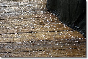
Sleet is a form of precipitation in which small ice pellets are the primary
components. These ice pellets are smaller and more translucent than hailstones,
and harder than graupel. Sleet is caused by specific atmospheric conditions and
therefore typically doesn't last for extended periods of time.
The condition which leads to sleet formation requires a warmer body of air to be
wedged in between two sub-freezing bodies of air. When snow falls through a warmer
layer of air it melts, and as it falls through the next sub-freezing body of air
it freezes again, forming ice pellets known as sleet. In some cases, water
droplets don't have time to freeze before reaching the surface and the result is
freezing rain.
Next Topic: Snow
Current conditions powered by WeatherAPI.com


