Weather Alert in Maine
Air Quality Alert issued August 2 at 2:56PM EDT by NWS Gray ME
AREAS AFFECTED: Northern Oxford; Northern Franklin; Central Somerset; Southern Oxford; Southern Franklin; Southern Somerset; Interior York; Central Interior Cumberland; Androscoggin; Kennebec; Interior Cumberland Highlands; Northern Coos; Southern Coos; Northern Grafton; Northern Carroll; Southern Grafton; Southern Carroll
DESCRIPTION: The New Hampshire Department of Environmental Services has issued an Air Quality Alert for particle pollution from 1 AM to 11 PM EDT Sunday. The New Hampshire Department of Environmental Services is predicting unhealthy air quality in Coos, Grafton and Carroll counties. Sensitive individuals include children and older adults; anyone with lung disease such as asthma, emphysema, and bronchitis; and people who are active outdoors. Even healthy individuals may experience mild health effects and should consider limiting strenuous or prolonged outdoor activities. The Maine Department of Environmental Protection's Bureau of Air Quality has issued an Air Quality Alert for particle pollution from 1 AM to 11 PM EDT this evening. Particle pollution levels are expected to reach Unhealthy for Sensitive Groups range Sunday for the Western Interior and Eastern Interior regions due to a plume of smoke expected to move in from Canada. For additional information, please visit the New Hampshire Department of Environmental Prediction website at, https://www4.des.state.nh.us/airdata/ In addition, A toll free air quality hotline has been established so Maine residents can stay informed on the air quality situations. The toll free number is: 1-800-223-1196.
INSTRUCTION: N/A
Want more detail? Get the Complete 7 Day and Night Detailed Forecast!
Current U.S. National Radar--Current
The Current National Weather Radar is shown below with a UTC Time (subtract 5 hours from UTC to get Eastern Time).

National Weather Forecast--Current
The Current National Weather Forecast and National Weather Map are shown below.

National Weather Forecast for Tomorrow
Tomorrow National Weather Forecast and Tomorrow National Weather Map are show below.

North America Water Vapor (Moisture)
This map shows recent moisture content over North America. Bright and colored areas show high moisture (ie, clouds); brown indicates very little moisture present; black indicates no moisture.

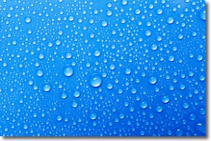
Weather Topic: What is Evaporation?
Home - Education - Precipitation - Evaporation
 Next Topic: Fog
Evaporation is the process which returns water from the earth
back to the atmosphere, and is another crucial process in the water cycle.
Evaporation is the transformation of liquid into gas, and it happens because
molecules are excited by the application of energy and turn into vapor.
In order for water to evaporate it has to be on the surface of a body of water.
Next Topic: Fog
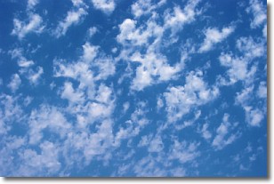
Weather Topic: What are Fractus Clouds?
Home - Education - Cloud Types - Fractus Clouds
 Next Topic: Freezing Rain
A fractus cloud (scud) is a fragmented, tattered cloud which has
likely been sheared off of another cloud. They are accessory clouds, meaning they
develop from parent clouds, and are named in a way which describes the original
cloud which contained them.
Fractus clouds which have originated from cumulus clouds are referred to as
cumulus fractus, while fractus clouds which have originated from stratus clouds
are referred to as stratus fractus. Under certain conditions a fractus cloud might
merge with another cloud, or develop into a cumulus cloud, but usually a
fractus cloud seen by itself will dissipate rapidly.
They are often observed on the leading and trailing edges of storm clouds,
and are a display of wind activity.
Next Topic: Freezing Rain
Current conditions powered by WeatherAPI.com


