Weather Alert in Alaska
Flood Watch issued August 24 at 3:34PM AKDT until August 28 at 10:00AM AKDT by NWS Anchorage AK
AREAS AFFECTED: Kuskokwim Valley West; Kuskokwim Valley East; Interior Kuskokwim Delta; Northern Bristol Bay Coast; Inland Bristol Bay
DESCRIPTION: * WHAT...Flooding caused by excessive rainfall is possible. * WHERE...Interior Kuskokwim Delta, Kuskokwim Valley, and northern Bristol Bay. * WHEN...From Monday morning through Thursday morning. * IMPACTS...Excessive rainfall and runoff may result in flooding of small streams, and other low-lying and flood-prone locations. Significant ponding of water, areal flooding, and erosion may occur in poor drainage areas. Flooding is not expected along the main Kuskokwim River and other major rivers. * ADDITIONAL DETAILS... - An atmospheric river will bring prolonged, widespread rainfall across Southwest Alaska this week. Steadier rainfall, which can be moderate to heavy at times, is expected to begin Monday and last through at least Wednesday with showers lingering through the rest of the week. Widespread rainfall totals of 1.5 to 3 inches is expected with locally higher amounts possible. This includes the communities around the Bethel area through Crooked Creek, and the Dillingham to Aleknagik area. The highest rainfall totals of at least 2.5 to 4 inches is expected close to the mountains near Togiak and the Western Capes. - Http://www.weather.gov/safety/flood
INSTRUCTION: You should monitor later forecasts and be alert for possible Flood Warnings. Those living in areas prone to flooding should be prepared to take action should flooding develop.
Want more detail? Get the Complete 7 Day and Night Detailed Forecast!
Current U.S. National Radar--Current
The Current National Weather Radar is shown below with a UTC Time (subtract 5 hours from UTC to get Eastern Time).

National Weather Forecast--Current
The Current National Weather Forecast and National Weather Map are shown below.

National Weather Forecast for Tomorrow
Tomorrow National Weather Forecast and Tomorrow National Weather Map are show below.

North America Water Vapor (Moisture)
This map shows recent moisture content over North America. Bright and colored areas show high moisture (ie, clouds); brown indicates very little moisture present; black indicates no moisture.

Weather Topic: What is Evaporation?
Home - Education - Precipitation - Evaporation
 Next Topic: Fog
Evaporation is the process which returns water from the earth
back to the atmosphere, and is another crucial process in the water cycle.
Evaporation is the transformation of liquid into gas, and it happens because
molecules are excited by the application of energy and turn into vapor.
In order for water to evaporate it has to be on the surface of a body of water.
Next Topic: Fog
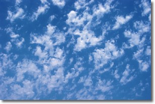
Weather Topic: What are Fractus Clouds?
Home - Education - Cloud Types - Fractus Clouds
 Next Topic: Freezing Rain
A fractus cloud (scud) is a fragmented, tattered cloud which has
likely been sheared off of another cloud. They are accessory clouds, meaning they
develop from parent clouds, and are named in a way which describes the original
cloud which contained them.
Fractus clouds which have originated from cumulus clouds are referred to as
cumulus fractus, while fractus clouds which have originated from stratus clouds
are referred to as stratus fractus. Under certain conditions a fractus cloud might
merge with another cloud, or develop into a cumulus cloud, but usually a
fractus cloud seen by itself will dissipate rapidly.
They are often observed on the leading and trailing edges of storm clouds,
and are a display of wind activity.
Next Topic: Freezing Rain
Current conditions powered by WeatherAPI.com


